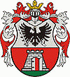
Nagykanizsa
 |
It lies not far from Lake Balaton at the meeting point of five routes. For centuries the town has been a connecting link. Goods from Slavonia were transported to Graz via Nagykanizsa, and the town played an important role in the trade from the Adriatic Sea to the Alpine region, Vienna, and Budapest.
The city's oldest Roman-era ruins were excavated in the 1960s. During the Middle Ages, Nagykanizsa became one of the most important strongholds of the Hungarian Kingdom. The fortress had a significant role in the southern shield-line of Hungary, guarding the whole of Western Europe against attacks by the Ottoman Empire.
The name Kanizsa was first mentioned in a document in 1245. The Kanizsai family continued building the castle and constructed a rectangular castle with an enclosed back yard on an islet in the River Kanizsa. The town and the castle were in their prime in the first half of the 16th century, when Kanizsa became a centre of trade with Italy and Styria.
Szigetvár and Kanizsa became the most important strongholds in southern Hungary. In 1600, the Turkish army occupied the castle. This castle was the center of an Ottoman eyalet including the sanjaks of Sigetvar, Kopan, Valpuva, Siklos, Nadaj, and Balatin until 1690 (see Ottoman Hungary), when the city was invaded by the Habsburg armies.
In 1601, during the Ottoman-Habsburg War of 1593–1606, a siege began on September 9 and ended on November 18. The Habsburg forces were commanded by Ferdinand, the Archduke of Austria, and Tiryaki Hasan Pasha commanded the defence of the castle. Hasan Pasha won the fight against the ten-times larger army of Austrians with many cunning military ploys, and was raised to the rank of Vizier.
At the beginning of the 18th century, the holder of the castle moved German, Croatian, and Serbian settlers into the deserted town. A particularly mixed ethnic group lived in a suburb called Kiskanizsa. After the Turks were driven out (1690), the town lost its strategic significance, so the Vienna war council demolished the castle in 1702.
Business became lively, trade became important again, and crafts developed significantly. In 1765 the Piarist order started to provide elementary and secondary education' supported by Lajos Batthyány, palatine of Hungary. The first business school of Transdanubia opened in Nagykanizsa, and in 1895 it was made into a college.
Many people who had attended Nagykanizsa's schools became famous: Benedek Virág, Pál Király, Ferenc Deák, Károly Kaán, Sándor Hevesi, and Ferenc Mező all studied in the ancient buildings of Nagykanizsa's almae matres.
Nagykanizsa started a new phase of large-scale development in the 1860s. The railway connecting Nagykanizsa with Vienna, Budapest, and Rijeka was constructed at that time. There was rapid development in industry as well. Industrial and commercial development resulted in the foundation of banks. Besides the four local banks, an Austro-Hungarian and an Anglo-Hungarian bank also opened branch offices in town. Telephone lines were established and the town was connected with a long-distance system in 1895. At the same time, a 70-bed hospital was opened.
Map - Nagykanizsa
Map
Country - Hungary
 |
 |
| Flag of Hungary | |
The territory of present-day Hungary has for centuries been a crossroads for various peoples, including Celts, Romans, Germanic tribes, Huns, West Slavs and the Avars. The foundation of the Hungarian state was established in the late 9th century AD with the conquest of the Carpathian Basin by Hungarian grand prince Árpád. His great-grandson Stephen I ascended the throne in 1000, converting his realm to a Christian kingdom. By the 12th century, Hungary became a regional power, reaching its cultural and political height in the 15th century. Following the Battle of Mohács in 1526, it was partially occupied by the Ottoman Empire (1541–1699). Hungary came under Habsburg rule at the turn of the 18th century, later joining with the Austrian Empire to form Austria-Hungary, a major power into the early 20th century.
Currency / Language
| ISO | Currency | Symbol | Significant figures |
|---|---|---|---|
| HUF | Hungarian forint | Ft | 2 |
| ISO | Language |
|---|---|
| HU | Hungarian language |


